Hydrological Studies Submission Process for Special Emergency Forces Sites
This project involved the preparation and formal submission of comprehensive hydrological studies for sites operated by the Special Emergency Forces across two geographically distinct regions of Saudi Arabia: Asir Region and Al-Ahsa Governorate. The work addressed the unique hydrological challenges posed by each region’s topography and climatic conditions.
| Client | Special Emergency Forces |
| Region | Asir Region and Al-Ahsa Governorate |
| Year | 2025 |
| Category | Hydrological Studies |
Objectives
- Analyze and document the hydrological characteristics of all designated Special Emergency Forces sites in Asir and Al-Ahsa.
- Develop site-specific hydrological assessments including surface runoff modeling, flood risk evaluation, and drainage capacity analysis.
- Prepare regulatory-compliant study reports for submission to relevant government authorities.
- Recommend infrastructure improvements to mitigate hydrological risks at operational sites.
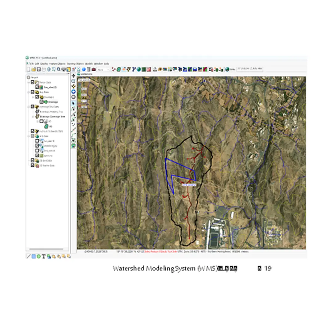
Methodology
The study combined field data collection, remote sensing analysis, and hydrological modeling using advanced software tools. Rainfall-runoff analysis was performed using historical precipitation records. Topographic surveys were integrated with GIS mapping to delineate watersheds and assess drainage networks. Flood frequency analysis was conducted to determine design return periods.
Deliverables
- Hydrological study reports for each site in Asir Region and Al-Ahsa Governorate.
- GIS-based watershed and drainage maps.
- Flood risk assessment and zoning maps.
- Engineering recommendations and submission packages for regulatory approval.
Significance & Impact
This study ensures the operational safety and infrastructural resilience of Special Emergency Forces sites by providing data-driven hydrological guidance. It supports long-term planning and risk management for critical security infrastructure in regions vulnerable to flash floods and seasonal rainfall events.